
.svg)


Question:
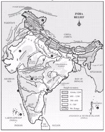
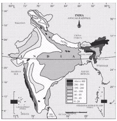
Study Map 1 and compare it with Map 2 and Map 3. Do you find any correlation between these maps?
Telagana became the 29th State of India in June 2014.
- State of Jammu and Kashmir was bifurcated into two unior territories namely Jammu and Kashmir and Ladakh on 05.08.19.
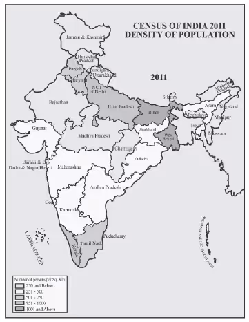
- Note – Telangana became 29th State of India in June, 2014.
*State of Jammu and Kashmir was bifurcated into two union territories namely Jammu and Kashmir and Ladakh on 05/08/19.
Answer:
Yes, these maps are correlated as they show that the nature of relief and the amount of annual rainfall are the main determinants of the population density in a region. The areas which have high population density are those areas which have plains and high annual rainfall. These areas have fertile soil for good agriculture that's why more people prefer to live in such areas. Desert or hilly areas have the least population because these areas have extreme weather conditions, less rainfall, and infertile soil which make the place unsuitable for habitation.


